

ALOS K&C mosaics#
Create and manipulate ALOS K&C mosaics
This module allows users to:
extract ALOS Kyoto & Carbon (ALOS K&C) mosaics by JAXA;
display the mosaics in interactive maps; and
export the mosaics as Google Earth Engine (GEE) assets and/or SEPAL .tif files.
Designed on top of the interactive framework sepal_ui, it was adapted to the SEPAL environment from this script by Vollrath.
Necessary inputs include:
an area of interest (AOI)
a year
select filters
The three-step process is described in the subsections below, as well as presented in the following video tutorial.
Select an AOI#
Using the provided AOI selector, select an AOI of your choice between the different methods available in the tool. We provide three administrative descriptors (from level 0 to 2) and three custom shapes (drawn directly on the map, asset or shapefile).

AOI selector#
Note
If a custom AOI from a shape or drawing is selected, you will be able to use it directly (the upload to GEE will be launched in the background).
Process mosaic#
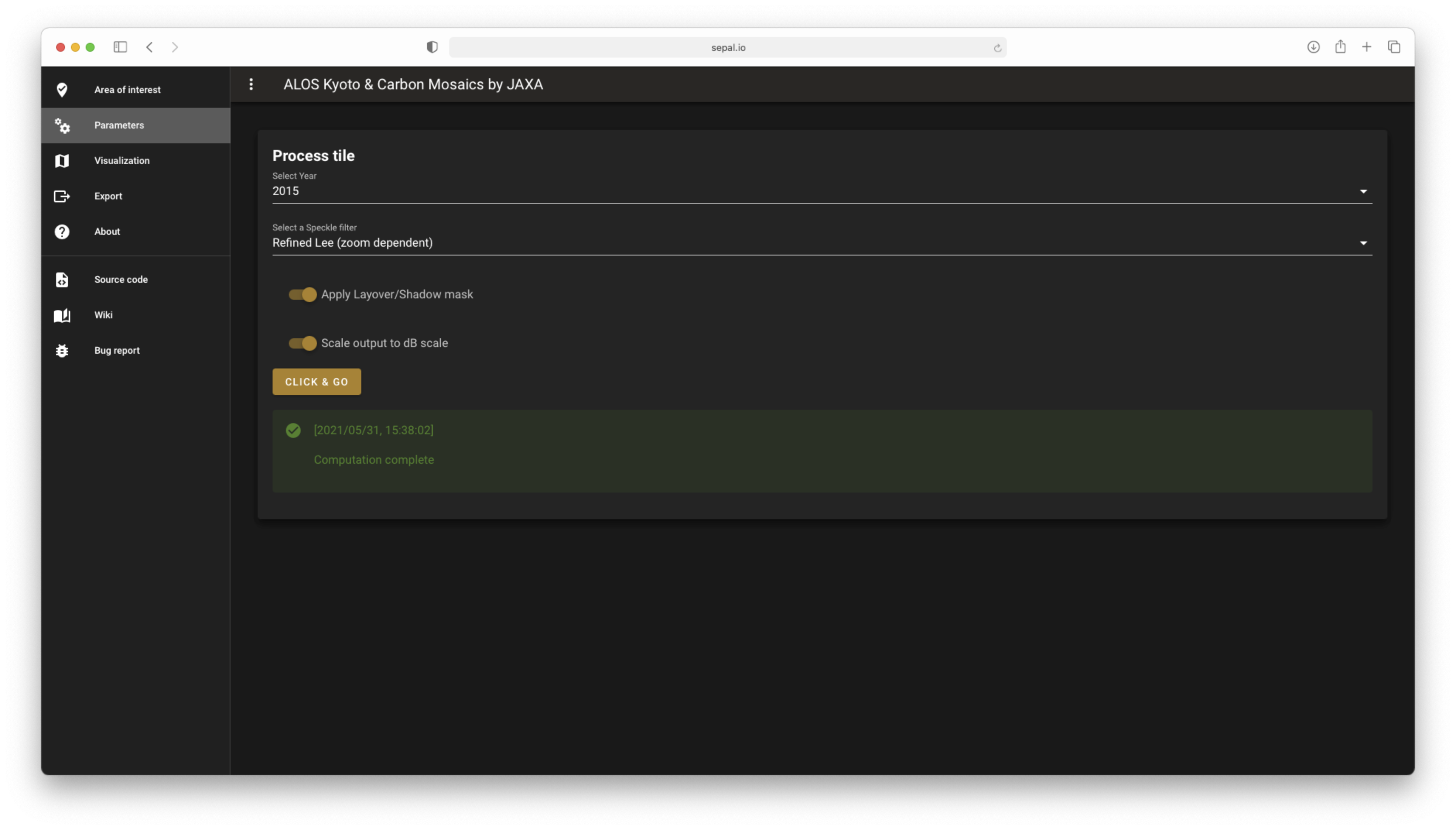
In the Process tile, set the different parameters of your mosaic:
Year: the year of interest
Speckle filter: the speckle filter to use during the process - no filter - refined lee: speckle noise removal technique based on the Lee Filter (for more information, see A.S. Yommy et al.). - Quegan filter: See Quegan et al.
Shadow masking: activate or deactivate shadow masking
Db: whether or not to scale the output to Db
After setting your parameters, select the button (the dataset will be automatically sent to the Vizualization tile).
Dataset parameters#
Display dataset#
The dataset is automatically displayed on the interactive map, allowing you to zoom in and out.
Choose from three diplay options:
Backscatter RGB (HH, HV, HH/HV power ratio)
Radar Forest Degradation Index (RFDI, Mitchard et al., 2012)
Forest/Non-Forest
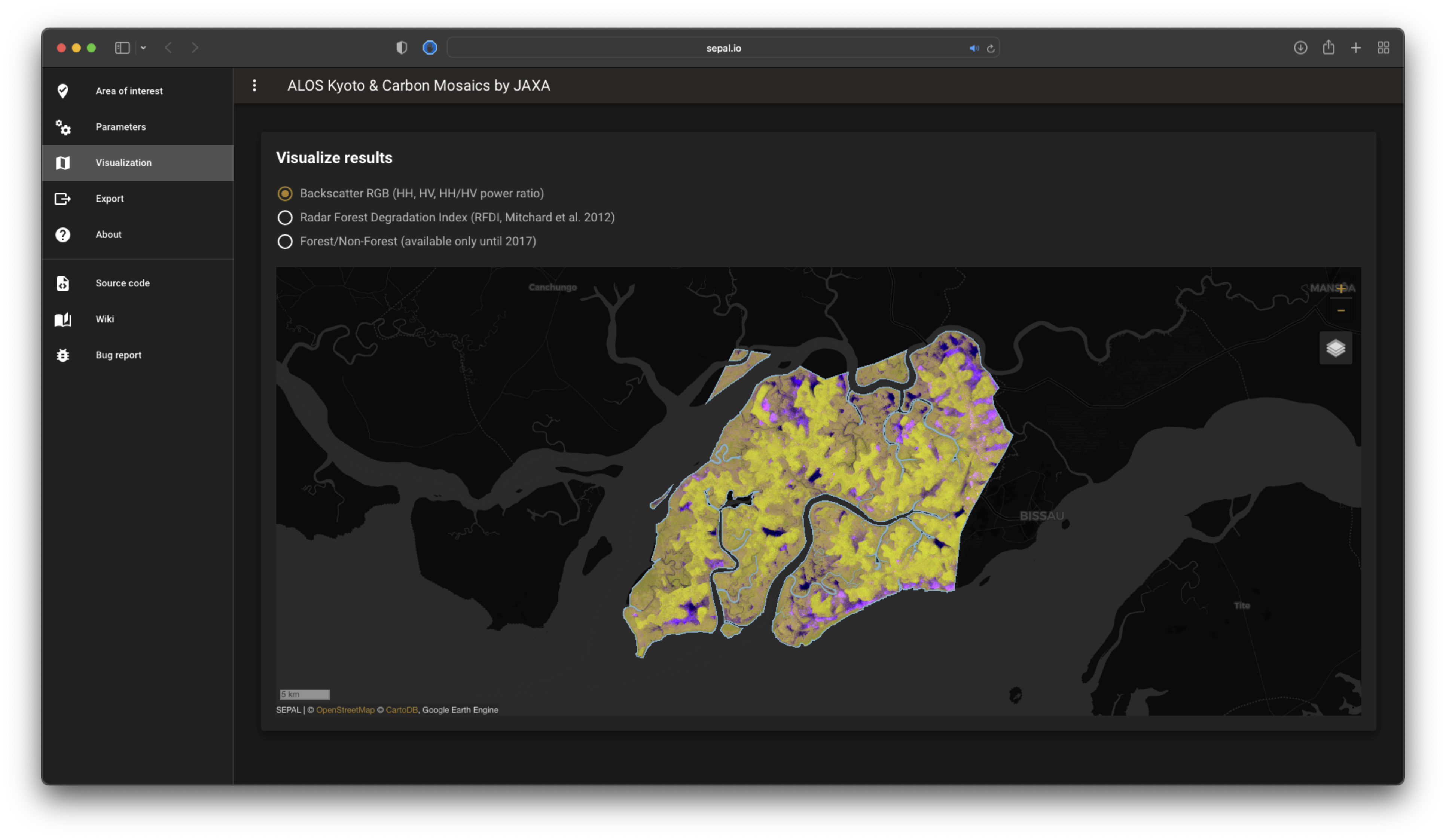
Display information#
Export dataset#
When you’re satified with the information displayed, it can be exported for further use in GIS software or in a GEE process. The tool provides two main exportation options:
an asset (in GEE), or
a .tif file (in SEPAL).
Both use the GEE export system and share the same set of parameters:
Export backscatter (HH, HV, HH/HV power ratio)
Export/add Radar Forest Degradation Index (RFDI, Mitchard et al., 2012)
Export/add GLCM texture layers for HH and HV polarizations (Variance, Homogeneity, Dissimilarity)
Export/add auxiliary metadata layers (Acq. Date, LIA, QA layer)
Export K&C forest/non-forest map (separate file)
Set the resolution as an integer number
Note
The default export parameters include: 25 m resolution with backscatter and RFDI.
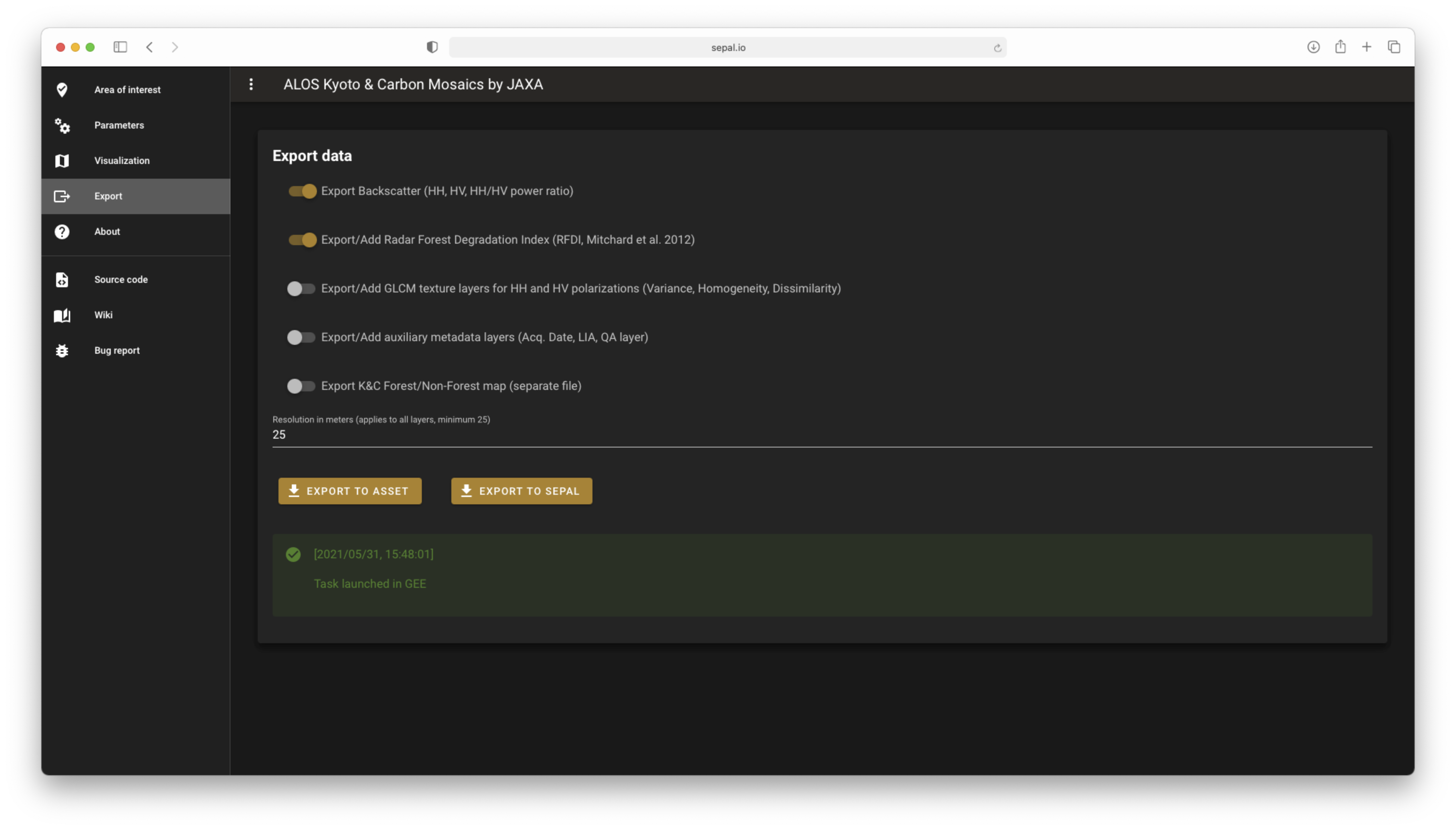
Export#
Attention
When exporting images to SEPAL, do not quit the application until the downloading process is complete.